
The validation, which marks months of activities, including community engagement, participatory mapping, and data collection, was conducted in accordance with articles 37 and 38 of the Land Rights Act of 2018, which promote legal recognition and responsible management of customary land through inclusive community-led planning.
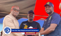
Speaking on behalf of the technical team from the LLA, Hon. Uriah Garsinii, Commissioner, Land Use and Management, emphasised that validation ensures the final plan, which reflects the true will of the community. “First of all, I want to extend thanks and appreciation to everyone of you for your commitment to this process. We are here to review what you have done as a community, and not to impose anything. What you have done as a community reflects the community decisions.” He added.
Commissioner Garsinii further informed the community that the Participatory Land Use Plan (PLUP) will help guide land use and development decisions for the next five years. Stating that the plan can only be reviewed and updated after five years. The LLA Land Use and Management boss further informed participants to be mindful of their decisions and, thus, must ensure their decisions are accurate. Hon. Garsinii further praised the community for its cooperation and informed them that the next DLF project will help strengthen local land governance.
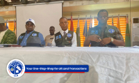
Alexander Cole, Program Manager, FCI, who spoke on behalf of the institution, stressed that the process is more than just a procedural step. He said the process is about community accountability and ownership. He informs residents and participants to raise any concerns if they feel unclear about the exercise, since the activity is about them. He stated the process is not just about validation, but to verify the future of the community. He further praised the Land Authority leadership for initiating an approach that includes women, youth, elders, traditional leaders, and persons with disabilities. “When the community owns the plan, it becomes a powerful tool for development and land justice,” he noted.
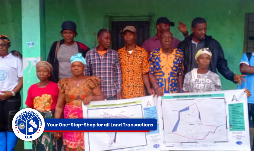
Meanwhile, during his technical presentation, the Assistant Director for Land Use Planning and GIS Specialist, William Dunn, LLA, highlighted the importance of verifying geospatial data along with the written plan. He said the exercise, which is not limited to validating text, also focuses on validating spatial data, confirming whether the mapped areas (farming, housing, forests, shrines) or protected lands are correct and reflect what the community agrees upon.
Mr. Dunn carefully guided participants, encouraging them to raise questions and corrections to ensure accuracy. “What we finalize today will guide how this land is used for the next five years. This is why we need you to be critical, detailed, and engaging since the validation is not for the LLA but for you, the community. He added.
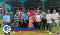
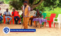
The activity, which was supported by the Tenure Facility, brought together over thirty community stakeholders, including members of the Community Land Development and Management Committee (CLDMC) and local government representatives.
However, the Participatory Land Use Plan process, which forms part of the customary land formalization procedures, is designed to establish legally sound and community-driven frameworks for land use that meet the community values and needs. These plans serve as a foundation for sustainable development, conflict resolution, and responsible resource management, thus empowering local communities to take ownership of their land and future.
For all your land transactions, kindly visit any of the Liberia Land Authority offices across the fifteen counties of Liberia.
Keep following for more updates! You can also follow us on Facebook at, Liberia Land Authority
Published by: Davis Emmanuel Chedeh